

SCOPE |
: |
Cultural Mapping |
CURATOR |
: |
cultureNOW |
GALLERY |
: |
Boston Society of Architects |
Mapping controls our perception and impacts the way we understand our environment. In the past, the map itself was a precious object. Used by property owners to define boundaries, by the military to fight wars, by explorers for navigation, and by municipalities to fight fires - the embodied an extraordinary investment of time and resources that gave the owner the power to shape the world. With technological advances like GIS, Google Maps and smart phone technology, the relationship between the map and its user changed dramatically. No longer a precious object, new maps are generated constantly and instantaneously. Access has been expanded from several hundred to millions. Even the ownership and creation of maps has shifted toward the user with the advent of customization and consumer input. This new technology marks a fundamental shift not only in the map as object but also in its power to influence perception.
Map-making is an exercise in choice. The vast information available on a given site’s historical and cultural make-up presents a unique and challenging task: how to capture the essence of a place and communicate that intangible quality to an audience. By definition, the process necessitates a curatorial and selective approach. Layering, comparison and mash-up are effective tools, juxtaposing historical data with current cultural trends, but even complex data is limited to what the mapmaker's can feasibly incorporate. Before the internet, a map was an object frozen in time by the printing process, the mapmaker's choices fixed permanently in place. Today, instantaneous access to a mobile database — the app — has fundamentally altered this problem. Choice, while still a curatorial exercise, is no longer static: it is a dialogue between the city, the user and the mapmaker.
Many cities and organizations are embracing this wealth of digital technology to make their environments more accessible. Downloadable maps are readily available to the casual tourist, cell phone tours have proliferated in the historical districts, and QR codes are plastered on the side of buildings and products, all in an attempt to engage both the visitor and the resident in the built environment. cultureNOW has collapsed these tools into one seamless program, allowing the user to navigate a city with text, photos and audio at their fingertips.
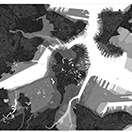
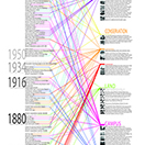
This exhibition views Boston through the lens of cultureNOW’s Museum Without Walls. Merging historical data with the power of smartphone technology, the gallery highlights Boston's development, while also capturing the city in the moment. It allows the user to meet some of the artists, architects, historians, planners and visionaries who have shaped Boston, and in so doing, understand the shape of Boston itself. Like the Museum Without Walls, this map is a work in progress. In conjunction with the cultureNOW app, it is part of the continuous process of defining a city. As cultureNOW expands its database and deepens its understanding of Boston, this map will change and adapt. This is a snapshot of BostonNOW.
The exhibition was presented from August, 2012 to Present
